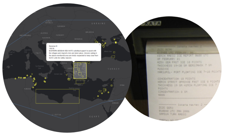
Released in 2019 as an extension to our Navarea warning app available on Android and Apple devices, Our Navarea warning API's are the one stop shop for nav area warnings, no more checking various websites for in-force and cancelled warning, use as a back up to your hardware receiver
We have advanced API's for our navarea warning dataset, perfect for integrating into your own systems and easy for developers to work with.
All warnings are checked and validated every 15 minutes so you never miss any data, all coastal warnings are included
|
NavArea
|
Year
|
Message
|
|---|---|---|
| Murmansk | 2025-12-03 10:16:00.153 | COASTAL WARNING WEST MURMANSK 383 CHART 12000
BARENTS SEA
1. NAVAL TRAINING EXERCISES FROM 01 TO 31 DEC 24 HOURS A DAY IN NAVIGATION PROHIBITED AREA 69-28.0N 034-47.0E 69-28.0N 035-10.5E 69-21.5N 035-10.5E 69-21.5N 034-47.0E 2. CANCEL THIS NR 01 JAN 2026= 281000 MSK GS- |
| Murmansk | 2025-12-03 10:00:08.773 | MURMANSK 01 28/11 1800=
COASTAL WARNING WEST MURMANSK 382 CHART 12000
EAST OF KILDIN ISLAND 1. NAVIGATION PROHIBITED FOR ALL VESSELS 01 TO 31 DEC 24 HOURS A DAY IN AN AREA WITH A RADIUS OF 1000 METERS FROM 69-19.1N 034-33.4E 2. CANCEL THIS NR ON 01 JAN 2026= 281000 MSK GS- |
| Murmansk | 2025-11-27 17:16:00.26 | 10 DAY TRANSMISSION
COASTAL WARNING WEST MURMANSK 381 CHART 12000
EAST OF RYBACHY PENINSULA 1. ARTILLERY FIRINGS 03 TO 07 DEC 0500 TO 1900 IN THE PROHIBITED NAVIGATION AREA 69-41.0N 033-06.5E 69-43.1N 033-19.0E 69-43.1N 033-31.0E 69-34.5N 033-31.0E 69-32.0N 033-13.0E 69-32.0N 032-51.0E 69-34.3N 032-51.0E THEN ALONG THE COASTLINE TO 69-41.0N 033-06.5E 2. CANCEL THIS NR 072000 DEC= 271000 MSK GS- |
| Murmansk | 2025-11-27 17:16:00.213 | TRANSMIT 13 DAYS
COASTAL WARNING WEST MURMANSK 380 CHART 11115
BARENTS SEA POMORSKY STRAIT 1. MISSILE LAUNCHES 03 TO 10 DEC 0600 TO 1500 NAVIGATION PROHIBITED IN TERRITORIAL WATERS DANGEROUS BEYOND THEM AREA 69-08-48N 051-23-55E 68-57-35N 052-02-49E 68-15-40N 050-15-12E 68-28-22N 049-41-55E 2. CANCEL THIS NR 101600 DEC= 271000 MSK HS- |
| Murmansk | 2025-11-27 17:17:00.41 | TRANSMIT FOR 9 DAYS
COASTAL WARNING WEST MURMANSK 379 CHART 10100
BARENTS SEA POMORSKY STRAIT AND CHESHSKAYA BAY 1. MISSILE FIRINGS FROM 03 TO 06 DEC 0300 TO 1700 NAVIGATION PROHIBITED IN TERRITORIAL WATERS DANGEROUS BEYOND THEM IN AREA 68-42.0N 048-40.0E THEN ALONG THE COASTLINE TO 68-48.0N 049-24.0E 68-26.0N 050-58.0E THEN ALONG THE COASTLINE TO 68-25.0N 051-00.0E 68-21.0N 051-06.0E THEN ALONG THE COASTLINE TO 68-23.0N 046-08.0E 2. CANCEL THIS NR 061800 DEC= 271000 MSK GS- |
| Taiwan NTM | 2025-11-28 11:17:00.51 | 190 (T) Taiwan Southeast Waters – Firing Exercise
Taiwan Southeast Waters Source National Chung Shan Institute of Science & Technology, letter No. 1140060719 dated November 24, 2025. Details 1. The live ammunition fire exercise will take place in December 2025. Regulated content is shown as attachment. 2. During the exercise period, all vessels are prohibited from sailing the exercise waters. Charts affected 0313 - 0343 - 0344 - 04501 - 04522 - 04523 - 04524 - 0471B In Area (A): 22°18'00.0"N, 120°54'30.0"E 22°05'00.0"N, 120°53'00.0"E 22°00'00.0"N, 121°04'00.0"E 22°22'00.0"N, 121°04'00.0"E Times (local): 2025-12-10 to 2025-12-12 0800–1200, 1300–1700 2025-12-16 to 2025-12-19 0800–1200, 1300–1700 In Area (B): 22°32'00.0"N, 121°02'00.0"E 22°19'00.0"N, 120°53'00.0"E 22°06'00.0"N, 120°53'00.0"E 22°06'00.0"N, 121°56'00.0"E 22°32'00.0"N, 121°56'00.0"E Times (local): 2025-12-11 to 2025-12-12 0900–1030 2025-12-18 to 2025-12-19 0900–1030 NTM URL: https://navy.mnd.gov.tw/Files/Others/25-190(民).pdf |
| Navarea XX | 2025-11-28 07:17:00.48 | NAVAREA 200 164/25 CHART 11115
BARENTS SEA POMORSKY STRAIT
1. MISSILE FIRINGS 03 TO 10 DEC 0600 TO 1500 NAVIGATION PROHIBITED IN TERRITORIAL WATERS DANGEROUS BEYOND THIS LIMIT IN AREA 69-08-48N 051-23-55E 68-57-35N 052-02-49E 68-15-40N 050-15-12E 68-28-22N 049-41-55E 2. CANCEL THIS MSG 101600 DEC= NNNN |
| Arkhangelsk | 2025-11-28 11:00:13.043 | 1. ARTILLERY FIRING 01 TO 05 DEC 0800 TO 1400
NAVIGATION PROHIBITED AREA 65-04.5N 039-38.0E 65-04.5N 039-48.0E 64-57.0N 039-59.2E 64-48.5N 039-38.0E 2. CANCEL THIS NR 051500 DEC= 281100 MSK GS- |
| Arkhangelsk | 2025-11-28 09:16:00.54 | 1. MISSILE FIRINGS FROM 03 TO 06 DEC 0300 TO 1700
IN THE PROHIBITED NAVIGATION AREA 67-12.0N 041-20.0E 67-40.0N 044-02.0E FOLLOWING THE COASTLINE TO 65-01.5N 040-11.0E 64-53.0N 039-24.0E 65-39.0N 037-37.0E 66-06.0N 039-05.0E FOLLOWING THE COASTLINE TO 67-12.0N 041-20.0E EXCLUDING MORZHOVETS ISLAND 2. CANCEL THIS NR 061800 DEC= 281000 MSK GS- |
| Navarea XIV | 2025-11-06 00:51:00.43 | VANUA LEVU - NORTH COAST
MALAU PORT
1. HYDROGRAPHIC SURVEY IN PROGRESS BY FIJI NAVY IN AREA BOUND BY: A. 16-21.67S 179-19.24E B. 16-21.46S 179-20.53E C. 16-21.30S 179-22.13E D. 16-21.52S 179-22.14E E. 16-21.70S 179-21.88E F. 16-22.00S 179-20.00E 2. WIDE BERTH REQUESTED 3. CANCEL THIS MESSAGE 060001 UTC DEC 2025 |
Start using Navareas for free by signing up. We also offer a monthly or yearly subscription to unlock more features.